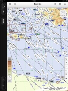
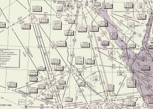
 While the little excursion around the home aerodrome only requires a quick look at the map and the weather report, planning our adventure is a tad more complex: during our flight to Egypt we will be crossing several borders and there thus required to file a “flight plan”. This plan contains the exact route, time, details on the aircraft and crew and a few additional things and has to be submitted with the authorities before takeoff. This is not an issue as flight plans can also be used for domestic flights and every pilot should be familiar with them. Customs clearance which has to be requested upfront (we are going to leave the EU and Schengen) is a no brainer and free of charge.
Several other factors make it more complex: while Germany is a private pilot’s paradise with excellent maps, a large number of public airfields, a reliable weather service and excellent air traffic control, things are rather different south of the Alps. In Greece, flying according to visual flight rules (VFR, the most common way of flying for private pilots) is possible but there are no official maps. One has to be creative. In Egypt, self controlled VFR isn’t possible at all, only controlled VFR (CVFR) and instrument flight (IFR) as used by airliners. IFR allows penetrating clouds and therefore reaching the destination when the weather is less than great but one is bound by the instructions of air traffic control (ATC) who will issue course and altitudes and any deviations like circling overhead your friend’s house and greeting are not possible (our route will lead us directly overhead the Pyramids of Cairo so it’s a pity).
 We will be flying “IFR”, i.e. under Instrument Flight Rules but still have to be prepared for safety (weather) or emergency (technical problem) landings at any other aerodrome on the way. This requires maps for both visual and instrument flying and landing charts for all airports that are close to our route. All this information has to be up to date. Luckily we didn’t plan this trip 5 years ago as we would have had to reserve half of our useable load for the paper binders with the maps. Not just impractical for logistics but also an issue when a chart is needed due to a diversion and there is limited time to go through books and find the right paper. Today one can fly truly paperless. The GPS devices come with a “moving map” and on two iPads, we will be carrying all required checklists, landing charts, IFR and VFR maps. As we have two devices, there is sufficient redundancy.
We’ve already determined our preferred routing. It will lead us from our home base Heubach (near Stuttgart) in southeasterly direction to the Alps, Austria, Slovenia, Croatia, Albania, Greece and the open sea to Egypt. Due to the aircraft’s endurance, customs (we’re not just leaving the EU but also Schengen) and cost (aircraft fuel is extremely expensive in Egypt and we want to buy as little as possible there) we need several stopovers. The first one in Dubrovnik (Croatia), the second in Sitia (on Crete in Greece), the third in Port Said (Egypt) as the port of entry and then onward to our destination El Gouna at the Red Sea.
We’ve prepared all maps, opening hours, fuel prices for this route and taken a first look at the landing procedures. Next we will have to come up with a list of alternate airports in case we have to divert, due to bad weather, revolution in Port Said, strikes in Greece, a technical problem, etc.
